Some Methods for Indicating Cartographic Uncertainty, Fifteenth through Eighteenth Centuries
DOI:
https://doi.org/10.55283/jhk.13795Keywords:
history of cartography, maps, uncertainty, Abraham Ortelius, Didier Robert de Vaugondy, Alexander DalrympleAbstract
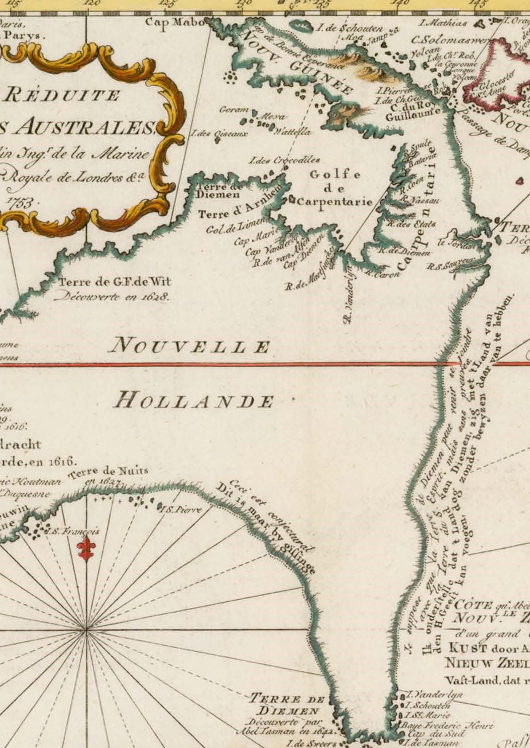
We have a strong tendency to trust maps as accurate depictions of the world, and most early modern cartographers are content to enjoy that prima facie trust without raising questions about the trustworthiness of their sources. In this article I will examine several methods that cartographers used from the fifteenth to the eighteenth centuries of departing from this convention, and indicating to their viewers in a forthright manner which parts of their map they were certain about, and which they were uncertain about. Some of these methods include listing sites about whose location the cartographer is uncertain, using a different graphic style to depict unknown coastlines, using signs to distinguish between certain and uncertain regions, and surrendering to uncertainty and reprinting varying maps of the same region together. Determining what earlier scholars did not know, and how they dealt with that lack of knowledge, is an essential step in producing the history of knowledge.
Downloads
Downloads
Published
Issue
Section
License
Copyright (c) 2023 Chet Van Duzer

This work is licensed under a Creative Commons Attribution 4.0 International License.

