
To Map, To Ascertain
Reflections on the Practice of Mapping (Un)certain Knowledge from a Digital Humanities Perspective
DOI:
https://doi.org/10.55283/jhk.14640Keywords:
geohumanities, historical GIS, uncertainty, visualizations, cartographyAbstract
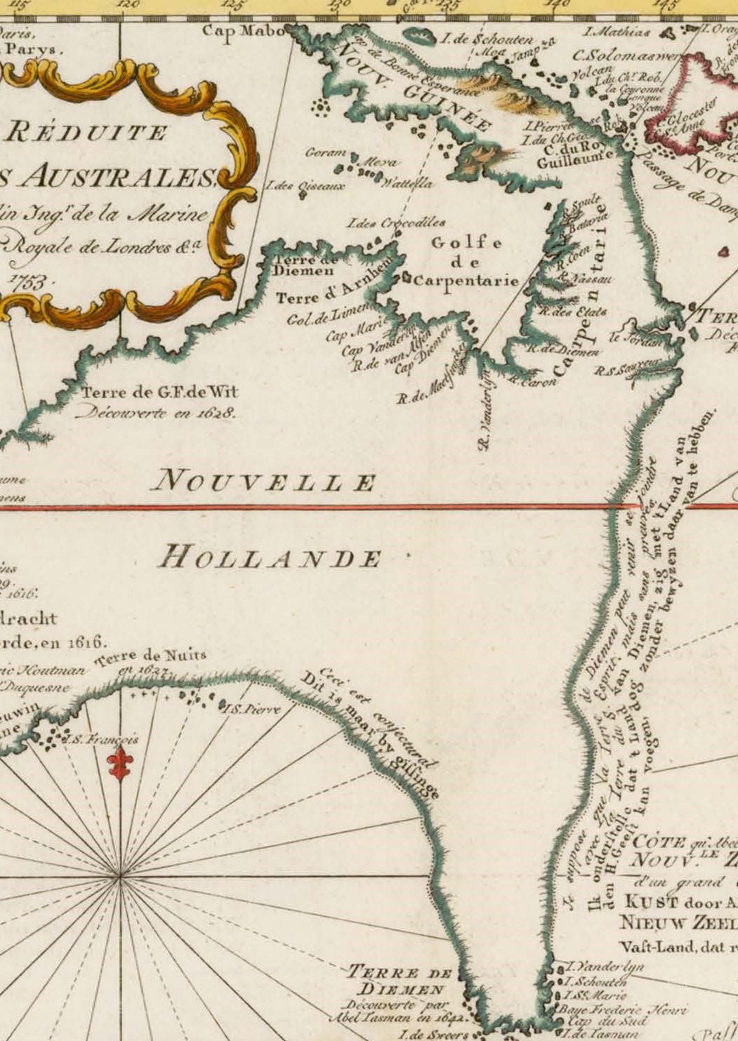
This paper offers a reflection on the theme of this special issue, how mapmakers deal with uncertainty, from a digital humanities perspective. For modern geohumanities scholars and digital mapmakers working in the field of history, dealing with the dual uncertainties of historical data and historical societies themselves can be a difficult task. How do they deal with these challenges? Do we use similar solutions to deal with uncertainty? Can we learn from the practices of early modern cartographers? And to what extent is (un)certainty itself a fruitful research topic in the geohumanities? To answer these questions, it is important to consider the historical development of the field of geohumanities and why it has learned to adapt to dealing with uncertain or ambiguous knowledge. Practical examples from my own research demonstrate how modern geohumanities scholars are affected by the notion of uncertainty in different ways. These examples are linked to the contributions and questions raised in this special issue. The engagement with early modern cartographers shows how important it is for geohumanities scholars not only to invest in geospatial analysis tasks, but also to become cartographers themselves.
Downloads
Downloads
Published
Issue
Section
License
Copyright (c) 2023 Rombert Stapel

This work is licensed under a Creative Commons Attribution 4.0 International License.

