
Histories of Ignorance
2021 Special Issue
Edited by Peter Burke and Lukas Verburgt
Image: The Deluge. B.C. 2348' from Edward Quin's Historical Atlas (1830)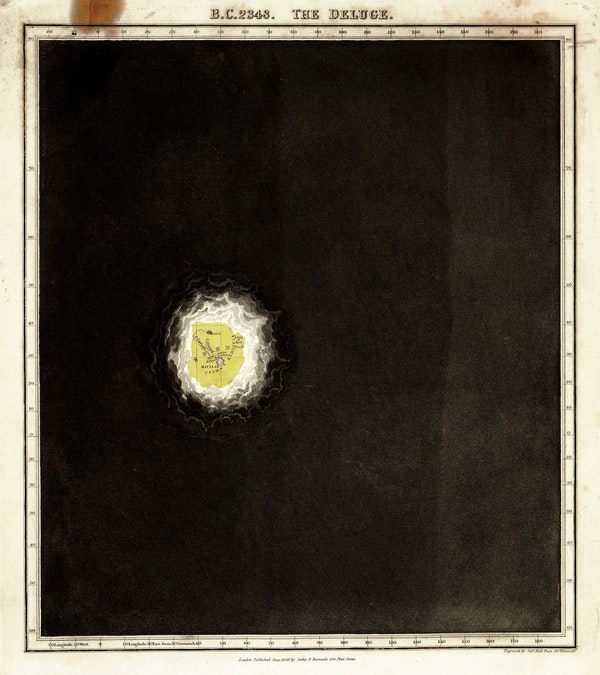
In his Historical Atlas, Oxford graduate, London barrister, and amateur cartographer Edward Quin (1794-1828) painted cartographic knowledge as a candle shining against the void of ignorance, represented by a mass of black cloud. Each map illustrated the bounds of geographical learning at a particular point in history, from a specific civilizational perspective, beginning with Eden, circa 'B.C. 2348'. The later maps in particular capture the fact that ignorance is always of something, and that one should always ask who is ignorant. For instance, in Quin's map 'A.D. 1498. The Discovery of America', North America, with its 'unnamed' eastern shores, is still covered in black clouds as if it were no-man's-land.

